Westerwood History
Westerwood, one of Greensboro’s first subdivisions, began to take root as residents bought sections of the wooded tract of land west of the city limits. North Buffalo Creek meandered along in a flood plain just north of this area. The north-south railroad tracks served as the eastern boundary. Some of the homes that were built in this area were large estates and some were small homes on single lots.
One large estate west of the city limits, built before 1879, was “The Cedars”, home of Doctor J. T. Battle. Dr. Battle’s estate was bound by the Atlantic and Yadkin Valley railroad tracks near Cedar St., N. Mendenhall St., Guilford Ave., and Lakeview St. Dr. Battle’s large Victorian home was later used by the North Carolina Children’s Home Society. Mr. John Linder, owner of Sun Coal and Seed, bought the home from Dr. Battle. After the Children’s Home Society moved, Mr. Linder remodeled the home into 10 apartments. All that remains of “The Cedars” is an outbuilding, seen behind 609 Courtland Ave. Modern apartment buildings in the 600 block of Fairmont St. now stand where Dr. Battle’s large Victorian home was.
%20(1200%20%C3%97%20600%20px)%20(1200%20%C3%97%20600%20px)%20(7).png)
In 1891, part of what is now Westerwood was annexed into the city limits. The rest was annexed in 1923. The earliest surviving original home on a single lot is at 605 Guilford Ave. It is a Queen Anne Cottage, built in 1900 for a Texas Oil Company agent, Edward Y. Wooten.
Early subdivision plats for this large wooded tract of land, some recorded in 1891, never were realized. Throughout the years, individual homes were built. At least 23 structures still remain from the days before Guilford Insurance and Realty Company acquired the unoccupied area for the first phase of Westerwood. Between 1919 and 1920, the Westerwood subdivision was officially born.
In 1921, Arthur K. Moore purchased the property from Guilford Insurance and started A. K. Moore Realty Company. In the 1920s, forty percent of the homes in Westerwood, and what was originally “West Market Terrace”, west of the Buffalo Creek tributary floodplain, were built. Development slowed during the Depression and World War II.
Before the Gaston St. Bridge was built in 1937, Gaston St. (now Friendly Ave.) started at the center of Greensboro and ended at Cedar Street. Mules hitched to drag pans created Friendly Rd. (now Ave.) as a dirt road west of the tributary that goes from Woman’s College (now UNCG) to the main channel of Buffalo Creek. Before Friendly Ave. was connected to the center of town, there were few houses from its beginning near Lake Dr. to Guilford College. It was largely woods from Market St. to Guilford Ave., which was only a dirt street at the time. After the Gaston St. Bridge was built and before Friendly joined Gaston, two houses had to be moved from the end of Lake Drive to the corners of Fairmont and Lake Drive, an exciting event to watch.
In 1926, Garland Daniel platted the Lake Daniel subdivision north of Buffalo Creek. The city purchased the Buffalo Creek flood plain for Lake Daniel Park. In his maps and promotional brochures, Daniel shows the park with tennis courts, lakes, winding paths, animal cages, and ponds for fish, waterfowl, and turtles. Because Buffalo Creek rises well beyond its banks during heavy rains, amenities such as animal cages and turtle ponds would not be practical.
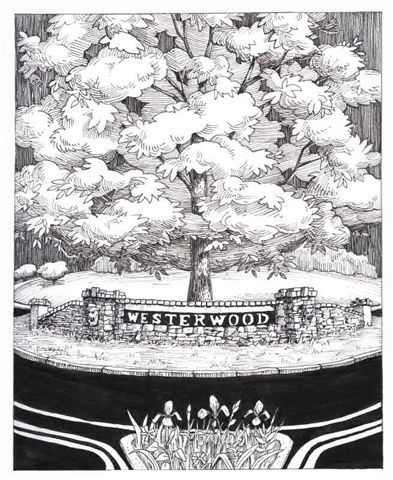
The Westerwood neighborhood was part of the inspiration for the Traditional Neighborhood Development movement. Streets were laid out with respect for the natural topography of the rolling hills. Originally, the streets were concrete, with granite curbs and brick gutters. Trees were planted in the wide grass strips between curb and sidewalk to give shade. Alleys provided access to garages and were used by service vehicles such as ice and coal trucks. As you can still see, garages were not prominent and some driveways were shared. Westerwood residents could walk to church, synagogue, stores, Woman’s College (now UNCG), Greensboro College, downtown, and to the park. By 1929, Greensboro High School (now Grimsley High School) was built just northwest of Lake Daniel Park, an easy walk from Westerwood. In 1902, electric streetcars began to turn on Tate Street from W. Market St. for access to the wider community. Two arched bridges, reminiscent of bridges in Europe, were built in Lake Daniel Park to span Buffalo Creek and its tributary. In 1925, Garland Daniel designed a large roundabout connecting Garland Drive and East Lake Drive. It is still in use.
Even now, Westerwood is a very walkable community. A walking/biking trail through Lake Daniel Park ends at Friendly Shopping Center to the west and Moses Cone Hospital to the east. Sidewalks connect Westerwood to the center of town and to nearby neighborhoods. Professors, teachers, journalists, artists, musicians, employers and employees lived, and continue to live, in Westerwood because of the neighborhood’s close proximity to schools, businesses, and downtown. Because of its convenient location, the number of apartments in the neighborhood began increasing through new construction and conversion of larger homes. In 2001, the City Council restored single-family zoning to the entire neighborhood.
Today, Westerwood neighbors gather together for picnics in the park, Easter Egg Hunts, Chili Cook-Offs, beautification events, and quarterly Westerwood Neighborhood Association meetings. Residents celebrate the holidays by decorating the two arched bridges and sharing a potluck supper.
Westerwood remains the same vibrant and friendly place that it has been since the early 1900s.
Delphina Street
In November 2022, Paul Evans, from Durham, NC, was chosen to design and create a bench for Westerwood. Per Dabney Sanders with the Downtown Greenway, “The bench will be located along the western branch section of the Downtown Greenway between Guilford Avenue and Smith Street. The location is just on the north-side of Guilford Avenue close to where the stream goes under the former railroad track – at the end of the parking area for those retail businesses”.
Read more from Paul as he shares his inspiration behind his bench design. He has named it Delphina Station after the history of Delphina Street that was uncovered while researching for the projects.
Delphina Station pays homage to the original residents of Delphina Street (now Guilford Avenue). In the early 1870s, the Mendenhall family sold lots to seven African-American individuals/families. The street was named after Delphina, an esteemed abolitionist and relative of Cyrus Pegg Mendenhall.
The installation resembles a train stop situated near a former railroad track and the woods, sparking the idea of a fictionalized stop within a conventional rail system and/or possibly connected to the Underground Railroad through the forest and creek. It includes African-inspired stools for rest, conversation, and reflection on the site's history and neighborhood's evolution.
At its center is a bottle tree, introduced by enslaved people to cleanse an area of negative energy. Engraved bricks surround the tree's base, honoring the original seven families of Delphina Street. The diverse array of multi-colored bottles symbolizes the community's present-day diversity. Delphina Station honors the heritage of Delphina Street's first residents, and encourages reflection and cleansing of negative energy.

In January 2023 , Benjamin Briggs with Preservation Greensboro wrote about the history of Delphina Street that he uncovered while helping Paul Evans research for his bench project. It was even discovered while doing genealogy work during the course of this research that Paul was a descendant of a former Delphina Street resident. What is now known as Guilford Avenue was once called Delphina Street. You can read Benjamin's excellent write-up about this history on the Preservation Greensboro website.
